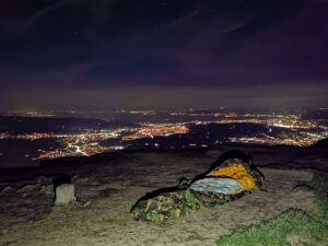
Here is a personal and ever-growing list of the world’s best hikes. It includes trails I’ve been lucky enough to complete, others that are high on my bucket list, and some fantastic recommendations from friends and guidebooks. It’s a celebration of adventure on two feet (and sometimes two wheels!).
Europe’s Majestic Peaks and Trails
Alta Via 1 & 2 (Italy)
- Distance: 120-150km
- Duration: 10-14 days
- Altitude Range: 1,400-2,800m
- Description: Iconic Dolomite trails with challenging climbs and stunning Alpine views. Alta Via 1 is the classic, more accessible route, while Alta Via 2 is longer and more demanding, featuring exposed sections and via ferrata.
- Access: Fly to Venice Marco Polo Airport, then take a bus to Cortina d’Ampezzo or Dobbiaco to start the trail.
- Alta Via 1 is also featured in a well-known book on the world’s best hikes.
Tour du Mont Blanc (France, Italy, Switzerland)
- Distance: 170km
- Duration: 7-11 days
- Altitude Range: 1,000-2,665m
- Description: A classic circuit around the Mont Blanc massif through three countries, offering a stunning mix of cultures, cuisines, and breathtaking alpine scenery.
- Access: Fly to Geneva Airport, then take a shuttle to Chamonix (1 hour), the traditional starting point.
- This hike is also featured in a well-known book on the world’s best hikes.
GR20 (Corsica, France)
- Distance: 180km
- Duration: 12-15 days
- Altitude Range: 400-2,600m
- Description: One of Europe’s toughest long-distance trails along Corsica’s mountainous spine, involving steep climbs, rocky scrambles, and basic chain sections.
- Access: Fly to Ajaccio or Bastia Airport, then take public buses to Calenzana (northern terminus) or Conca (southern terminus).
- This hike is also featured in a well-known book on the world’s best hikes.
Walkers’ Haute Route (France, Switzerland)
- Distance: ~200km
- Duration: 10-14 days
- Altitude Range: 1,600-3,000m
- Description: A spectacular high-altitude trek from Chamonix, France, to Zermatt, Switzerland. It stays below the glaciers but crosses 11 high passes with constant, epic views of 4,000m peaks including Mont Blanc and the Matterhorn.
- Access: Fly to Geneva Airport, then train/bus to Chamonix (starting point) or Zurich Airport, then train to Zermatt (ending point).
- This hike is also featured in a well-known book on the world’s best hikes.
Laugavegur Trail + Fimmvörðuháls (Iceland)
- Distance: 80km (combined)
- Duration: 5-7 days
- Altitude Range: 500-1,100m
- Description: Iceland’s most famous trail featuring geothermal areas, glaciers, and volcanic landscapes. The combined route offers an otherworldly journey through Iceland’s raw, elemental beauty.
- Access: Fly to Keflavik International Airport, take a bus to Reykjavik, then highland buses to Landmannalaugar (starting point).
- The Laugavegur Trail is featured in a well-known book on the world’s best hikes.
Kungsleden (Sweden)
- Distance: 440km (full trail); the northern section is ~105 km.
- Duration: 7 days (northern section) or ~30 days (full trail)
- Altitude Range: 300m – 1,150m
- Description: “The King’s Trail” through Swedish Lapland’s remote Arctic wilderness. The most popular northern section from Abisko to Nikkaluokta offers vast, open landscapes and a well-serviced network of huts.
- Access: Fly to Stockholm, then domestic flight or overnight train to Kiruna, followed by bus to Abisko (northern terminus).
- This hike is also featured in a well-known book on the world’s best hikes.
West Highland Way (Scotland)
- Distance: 154km
- Duration: 6-8 days
- Altitude Range: 10-550m
- Description: Popular long-distance trail through the Scottish Highlands with lochs and historic sites, journeying from the outskirts of Glasgow into dramatic Glencoe.
- Access: Fly to Glasgow Airport, then train to Milngavie (starting point) or Fort William (endpoint).
- This hike is also featured in a well-known book on the world’s best hikes.
Peaks of the Balkans (Albania, Kosovo, Montenegro)
- Distance: 192km
- Duration: 10-12 days
- Altitude Range: 800-2,300m
- Description: Trail network exploring the rugged Accursed Mountains, a cross-border journey into one of Europe’s last wild frontiers.
- Access: Fly to Tirana (Albania), Pristina (Kosovo), or Podgorica (Montenegro), then local transport to Theth or Valbona in Albania to start.
Arctic Circle Trail (Greenland)
- Distance: 160km
- Duration: 7-10 days
- Altitude Range: 0-450m
- Description: Remote trek through Greenland’s vast, icy landscapes, offering a true sense of solitude and wilderness.
- Access: Fly to Copenhagen, then Air Greenland to Kangerlussuaq (starting point) or Sisimiut (endpoint).
Trolltunga Trek (Norway)
- Distance: 28km round trip
- Duration: 10-12 hours or 2 days
- Altitude Range: 400-1,100m
- Description: A challenging but iconic hike to the famous rock formation “Troll’s Tongue” jutting out spectacularly over Lake Ringedalsvatnet.
- Access: Fly to Bergen or Oslo, then bus/train to Odda, followed by shuttle to the trailhead at Skjeggedal.
Slovenian Mountain Trail (Slovenia)
- Distance: 617km (full trail)
- Duration: 30-40 days (shorter segments possible)
- Altitude Range: 200-2,864m
- Description: Connects the Julian Alps, Kamnik-Savinja Alps, and Pohorje massif, traversing the country and summiting its highest peaks.
- Access: Fly to Ljubljana Airport, then bus to Maribor (eastern starting point) or Nova Gorica/Ankaran (western endpoints).
Berliner Höhenweg (Austria)
- Distance: ~85 km
- Duration: 7-9 days
- Altitude Range: Mostly above 2,000m, with the highest point at 3,134m.
- Description: A challenging, high-alpine hut-to-hut circuit in the Zillertal Alps for experienced hikers, rewarding them with glacial views and a true sense of the high mountains.
- Access: Fly to Innsbruck (INN) or Munich (MUC). The traditional start is from Finkenberg or Mayrhofen.
- This hike is also featured in a well-known book on the world’s best hikes.
Camino de Santiago (Spain & Portugal)
- Distance: Varies greatly; the classic Camino Francés is ~800 km.
- Duration: ~30-35 days (Camino Francés)
- Description: A famous network of ancient pilgrim routes across Europe, all leading to Santiago de Compostela in Spain. It’s a journey of culture, history, and social connection as much as a hike.
- Access: For the Camino Francés, travel to St-Jean-Pied-de-Port, France. For the Camino Portugués, start in Porto, Portugal.
- This hike is also featured in a well-known book on the world’s best hikes.
Dry Stone Route (GR221, Mallorca, Spain)
- Distance: ~140 km
- Duration: 8-10 days
- Altitude Range: Sea level – 1,200m
- Description: This route traverses the rugged Serra de Tramuntana mountains, a UNESCO World Heritage site, following ancient cobbled paths connecting charming mountain villages.
- Access: Fly to Palma de Mallorca (PMI). The trail runs from Port d’Andratx to Pollença.
- This hike is also featured in a well-known book on the world’s best hikes.
Eagles Walk (Austria)
- Distance: 413 km (full trail in 33 stages)
- Duration: Shorter sections of 3-7 days are common. The full trail takes about a month.
- Altitude Range: 500m – 2,800m
- Description: A long-distance path symbolizing an eagle’s flight across the state of Tyrol, allowing for anything from day hikes to a full traverse of the region’s stunning mountains.
- Access: Fly to Innsbruck (INN) or Munich (MUC). The trail’s stages are well-connected by public transport.
- This hike is also featured in a well-known book on the world’s best hikes.
Jämtland Triangle (Sweden)
- Distance: 47 km
- Duration: 3 days
- Altitude Range: ~800m – 1,100m
- Description: A classic and accessible hut-to-hut hike in the Swedish mountains, connecting the Storulvån, Sylarna, and Blåhammaren mountain stations. A perfect introduction to Scandinavian trekking.
- Access: Fly to Östersund (OSD) or Trondheim, Norway (TRD), then train/bus to Storulvån Mountain Station.
- This hike is also featured in a well-known book on the world’s best hikes.
John Muir Way (Scotland)
- Distance: 215 km
- Duration: 10-14 days
- Altitude Range: Mostly low-level, from sea level to ~400m.
- Description: A coast-to-coast route across Scotland’s central belt, honoring the conservationist John Muir. It links Helensburgh in the west with Muir’s birthplace, Dunbar, in the east.
- Access: Easily accessible by train from Glasgow (for Helensburgh) and Edinburgh (for Dunbar).
- This hike is also featured in a well-known book on the world’s best hikes.
Loire – the GR3, France
- Distance: 1,243 km
- Duration: ~2 months
- Description: One of the oldest long-distance trails in France, the GR3 follows the course of the Loire River from its mountainous source to its mouth on the Atlantic coast, passing through the famous chateaux region.
- Access: Starts at Mont Gerbier de Jonc and ends in La Baule, with numerous access points.
- This hike is also featured in a well-known book on the world’s best hikes.
Lycian Way (Turkey)
- Distance: ~540 km (often hiked in sections)
- Duration: ~29 days (full trail); sections of 7-10 days are popular.
- Altitude Range: Sea level – 1,800m
- Description: A stunning coastal trail in southwestern Turkey that combines breathtaking Mediterranean views with visits to ancient Lycian ruins, secluded coves, and friendly villages.
- Access: Fly to Dalaman (DLM) for the western end or Antalya (AYT) for the eastern end.
- This hike is also featured in a well-known book on the world’s best hikes.
Offa’s Dyke Path (England & Wales)
- Distance: 285 km
- Duration: 12-14 days
- Altitude Range: Sea level – 824m (Hay Bluff)
- Description: This National Trail follows the historic border between England and Wales, often tracing the 8th-century earthwork built by King Offa.
- Access: Starts near Chepstow and ends at Prestatyn.
- This hike is also featured in a well-known book on the world’s best hikes.
Painters Way (Malerweg, Germany)
- Distance: 112 km
- Duration: 6-8 days
- Altitude Range: 120m – 450m
- Description: A circular trail through the dramatic landscapes of Saxon Switzerland National Park, exploring rock formations and gorges that inspired Romantic-era painters.
- Access: Fly to Dresden (DRS). The trail starts and ends in Pirna, a short train ride away.
- This hike is also featured in a well-known book on the world’s best hikes.
Pembrokeshire Coast Path (Wales)
- Distance: 299 km
- Duration: 12-15 days
- Altitude Range: Sea level – 175m
- Description: A spectacular National Trail that hugs the Welsh coastline, renowned for its constant sea views, rugged volcanic cliffs, pristine sandy beaches, and abundant wildlife.
- Access: The northern start is St Dogmaels and the southern end is Amroth.
- This hike is also featured in a well-known book on the world’s best hikes.
Pennine Way (England & Scotland)
- Distance: 431 km
- Duration: 16-20 days
- Altitude Range: 100m – 893m (Cross Fell)
- Description: Britain’s oldest and most challenging National Trail, following the rugged “backbone of England.”
- Access: Starts in Edale and ends in Kirk Yetholm, Scotland.
- This hike is also featured in a well-known book on the world’s best hikes.
Picos de Europa Circuit (Spain)
- Distance: ~115 km (for the full circuit)
- Duration: 7-9 days
- Altitude Range: 300m – 2,400m
- Description: A demanding trek through the dramatic limestone massif of the Picos de Europa National Park, featuring deep gorges and high passes.
- Access: Fly to Santander (SDR) or Asturias (OVD), then bus to Potes or Poncebos.
- This hike is also featured in a well-known book on the world’s best hikes.
Haute Randonnée Pyrénéenne (France, Spain, Andorra)
- Distance: ~800 km
- Duration: 45-50 days
- Altitude Range: Sea level – 3,000m
- Description: The ultimate Pyrenean traverse, a high-level route that zig-zags across the French-Spanish border. Largely unmarked and for experienced, self-sufficient mountaineers only.
- Access: Starts in Hendaye, France and ends in Banyuls-sur-Mer, France.
- This hike is also featured in a well-known book on the world’s best hikes.
Rennsteig (Germany)
- Distance: 170 km
- Duration: 6-8 days
- Altitude Range: 200m – 982m
- Description: Germany’s oldest and most famous long-distance trail, following the ridge line of the Thuringian Forest.
- Access: Starts in Hörschel (near Eisenach) and ends in Blankenstein.
- This hike is also featured in a well-known book on the world’s best hikes.
Robert Louis Stevenson Trail (GR70, France)
- Distance: 274 km
- Duration: 12-15 days
- Altitude Range: 150m – 1,702m (Mont Lozère)
- Description: Follows the journey taken by the author with his donkey, Modestine. A beautiful walk through the rolling hills, forests, and plateaus of rural southern France.
- Access: Starts in Le-Puy-en-Velay and ends in Saint-Jean-du-Gard.
- This hike is also featured in a well-known book on the world’s best hikes.
Samaria Gorge (Crete, Greece)
- Distance: 16 km
- Duration: 4-6 hours (day hike)
- Altitude Range: Descends from 1,230m to sea level.
- Description: A classic and dramatic gorge walk in Crete, descending from the Omalos plateau to the Libyan Sea.
- Access: Typically done via an organized bus tour from Chania. You hike down and take a ferry from the endpoint.
- This hike is also featured in a well-known book on the world’s best hikes.
South West Coast Path (England)
- Distance: 1,014 km
- Duration: 7-8 weeks (full trail); week-long sections are very popular.
- Altitude Range: Sea level to 318m.
- Description: The UK’s longest and arguably most spectacular National Trail, tracing the entire coastline of England’s southwest peninsula. The total elevation gain is equivalent to climbing Everest four times.
- Access: Starts in Minehead, Somerset and ends in Poole Harbour, Dorset.
- This hike is also featured in a well-known book on the world’s best hikes.
Western Way (Ireland)
- Distance: ~200 km (can be done in sections)
- Duration: 9-11 days
- Altitude Range: Mostly low-level, with the highest point around 500m.
- Description: A long-distance trail through the wild and beautiful landscapes of counties Galway and Mayo, exploring the boglands and mountains of Connemara.
- Access: Starts in Oughterard (bus from Galway City).
- This hike is also featured in a well-known book on the world’s best hikes.
Switzerland’s Alpine Treasures
Matterhorn Circuit (Switzerland & Italy)
- Distance: ~145 km
- Duration: 8-10 days
- Altitude Range: 1,500m – 3,300m
- Description: This challenging trek circumnavigates the iconic Matterhorn and the wider Monte Rosa massif. It’s a quieter alternative to the TMB, offering incredible views of 4,000m peaks and crossing high, remote passes.
- Access: The loop can be started from Zermatt, Switzerland, or from several villages in Italy’s Aosta Valley.
- This hike is also featured in a well-known book on the world’s best hikes.
Grosser Mythen
- Distance: 5km round trip
- Duration: 3-4 hours
- Altitude Range: 1,100-1,899m
- Description: Steep but rewarding hike with 360° panoramic views of central Switzerland.
- Access: Fly to Zurich Airport, take train to Schwyz, then bus to Brunni and cable car to Holzegg (trailhead).
Jöriseen
- Distance: 14km round trip
- Duration: 5-6 hours
- Altitude Range: 1,800-2,650m
- Description: High-alpine lake circuit with stunning views of multiple glacier-fed lakes.
- Access: Fly to Zurich, train to Davos Dorf, then bus to Flüelapass (starting point).
Murgseen Wanderung
- Distance: 15km
- Duration: 5-6 hours
- Altitude Range: 910-1,820m
- Description: Beautiful trail passing three mountain lakes in the Heidiland region.
- Access: Fly to Zurich, train to Murg am Walensee station (starting point).
Muttsee and Limmerensee with Ruchi Wanderung
- Distance: 16km
- Duration: 6-7 hours
- Altitude Range: 1,100-2,800m
- Description: Challenging hike featuring two alpine lakes and peak ascent of Ruchi.
- Access: Fly to Zurich, train to Linthal, then cable car to Kalktrittli or Tierfehd (starting points).
Glattalpsee to Furggele and Ortstock Wanderung
- Distance: 18km
- Duration: 7-8 hours
- Altitude Range: 1,200-2,716m
- Description: Challenging route with lake views and optional summit of Ortstock.
- Access: Fly to Zurich, train to Glarus, bus to Richisau, then cable car to Glattalp (starting point).
North America’s Wild Wonders
John Muir Trail (California, USA)
- Distance: 340km
- Duration: 14-21 days
- Altitude Range: 1,200-4,421m (summit of Mount Whitney)
- Description: Legendary trail through Sierra Nevada, passing through Yosemite, Kings Canyon, and Sequoia National Parks. It is renowned for its stunning granite peaks, alpine lakes, and high passes.
- Access: Fly to San Francisco or Los Angeles, then drive or take public transport to Yosemite Valley (northern terminus) or Whitney Portal (southern terminus).
- This hike is also featured in a well-known book on the world’s best hikes.
Appalachian Trail (USA)
- Distance: ~3,500 km
- Duration: 5-7 months
- Altitude Range: 100m – 2,025m
- Description: One of the world’s most famous long-distance trails, stretching from Georgia to Maine through 14 states. A “thru-hike” is a monumental undertaking and a deep immersion into American hiking culture.
- Access: Starts at Springer Mountain, Georgia, and ends at Mount Katahdin, Maine.
- This hike is also featured in a well-known book on the world’s best hikes.
Chilkoot Trail (USA & Canada)
- Distance: 53 km
- Duration: 3-5 days
- Altitude Range: Sea level – 1,120m
- Description: Follows the historic path of the Klondike Gold Rush stampeders from Alaska into Canada. It’s a journey through coastal rainforest, high alpine terrain, and past hundreds of historical artifacts.
- Access: Starts near Skagway, Alaska, and ends at Lake Bennett, British Columbia, from where you take a scenic train back out.
- This hike is also featured in a well-known book on the world’s best hikes.
Colorado Trail (USA)
- Distance: ~800 km
- Duration: 4-6 weeks
- Altitude Range: 1,675m – 4,045m
- Description: A stunning high-altitude trail that traverses the Rocky Mountains from Denver to Durango, spending most of its time above 3,000m.
- Access: Starts in Waterton Canyon near Denver and ends in Durango.
- This hike is also featured in a well-known book on the world’s best hikes.
Long Trail (Vermont, USA)
- Distance: 439 km
- Duration: 20-30 days
- Altitude Range: 100m – 1,340m
- Description: The oldest long-distance trail in the United States, following the main ridge of the Green Mountains through Vermont. It’s known for being rugged, muddy, and quintessentially “New England.”
- Access: Runs from the Massachusetts border in the south to the Canadian border in the north.
- This hike is also featured in a well-known book on the world’s best hikes.
Pacific Crest Trail (USA, from Mexico to Canada)
- Distance: 4,265 km
- Duration: 4-6 months
- Altitude Range: Near sea level – 4,009m
- Description: One of the “Triple Crown” of American long-distance hiking, this monumental trail journeys from the deserts of Southern California, through the granite spires of the Sierra Nevada, and into the volcanic landscapes of the Pacific Northwest.
- Access: Starts at the Mexican border near Campo, California, and ends at Manning Park, British Columbia.
- This hike is also featured in a well-known book on the world’s best hikes.
Bright Angel to Rim-to-Rim (Grand Canyon, USA)
- Distance: 38-45km (depending on route)
- Duration: 2-3 days
- Altitude Range: 734-2,515m
- Description: Iconic descent into and ascent out of the Grand Canyon, an unforgettable journey through geological time.
- Access: Fly to Phoenix or Las Vegas, then drive (4-5 hours) or shuttle to Grand Canyon National Park.
- This hike is also featured in a well-known book on the world’s best hikes.
Yosemite Grand Traverse (California, USA)
- Distance: 100km
- Duration: 6-8 days
- Altitude Range: 1,200-3,600m
- Description: Challenging route through Yosemite hitting iconic landmarks.
- Access: Fly to San Francisco or Fresno, then drive or shuttle to Yosemite Valley.
West Coast Trail (British Columbia, Canada)
- Distance: 75km
- Duration: 5-7 days
- Altitude Range: 0-100m
- Description: Rugged coastal trail on Vancouver Island with beaches, rainforests, ladders, and wildlife.
- Access: Fly to Victoria or Vancouver, then take ferry/bus to Port Renfrew (southern terminus) or Bamfield (northern terminus).
Rockwall Trail (British Columbia, Canada)
- Distance: 55km
- Duration: 3-5 days
- Altitude Range: 1,600-2,350m
- Description: High-alpine trail in Kootenay National Park with towering limestone cliffs.
- Access: Fly to Calgary, then drive west on Highway 1 to Kootenay National Park (approximately 2 hours).
Banff Highline Trail (Alberta, Canada)
- Distance: 100km
- Duration: 7-10 days
- Altitude Range: 1,400-2,600m
- Description: Breathtaking views of the Canadian Rockies.
- Access: Fly to Calgary, then shuttle or drive to Banff (1.5 hours from airport).
Mount Smutwood (Alberta, Canada)
- Distance: 18km round trip
- Duration: 1 day (6-8 hours)
- Altitude Range: 1,750-2,500m
- Description: A friend recommended this as one of the best day hikes in the Canadian Rockies, famous for its golden larches in the fall and dramatic mountain scenery.
- Access: Fly to Calgary, drive to Kananaskis Country, trailhead is at Mount Engadine Lodge/Commonwealth Creek.
Kesugi Ridge Trail (Alaska, USA)
- Distance: 58km
- Duration: 3-4 days
- Altitude Range: 300-1,200m
- Description: Stunning views of Denali and the Alaska Range.
- Access: Fly to Anchorage, then drive or take train to Denali State Park, access trail via Parks Highway.
Kalalau Trail (Hawaii, USA)
- Distance: 35km (round trip)
- Duration: 2-3 days
- Altitude Range: 0-370m
- Description: Dramatic coastal trail on Kauai leading to remote Kalalau Valley.
- Access: Fly to Lihue Airport in Kauai, then shuttle or drive to Haena State Park (trailhead).
Wonderland Trail (Washington, USA)
- Distance: 150km
- Duration: 7-14 days
- Altitude Range: 760-2,070m
- Description: Circles Mount Rainier through varied terrain and ecosystems.
- Access: Fly to Seattle, then drive to Mount Rainier National Park (2.5 hours).
Mount Temple (Canada)
- Distance: 16km round trip
- Duration: 1 day (7-10 hours)
- Altitude Range: 1,700-3,544m
- Description: A challenging, non-technical scramble to one of the highest peaks in the Lake Louise area, offering incredible views.
- Access: Fly to Calgary, drive to Lake Louise area, trailhead is at Moraine Lake.
Zion Traverse (Utah, USA)
- Distance: 75km
- Duration: 4-5 days
- Altitude Range: 1,200-2,100m
- Description: Cross Zion National Park with dramatic canyon views.
- Access: Fly to Las Vegas or Salt Lake City, then drive or shuttle to Zion National Park.
Panorama Ridge (British Columbia, Canada)
- Distance: 30km round trip
- Duration: 1-2 days
- Altitude Range: 850-2,100m
- Description: Stunning 360° views of Garibaldi Lake, Black Tusk, and surrounding mountains.
- Access: Fly to Vancouver, then drive 1.5 hours north to Rubble Creek parking lot on Highway 99.
Skyline Trail (Jasper National Park, Canada)
- Distance: 44km
- Duration: 2-3 days
- Altitude Range: 1,200-2,510m
- Description: Alpine ridge trail with extensive above-treeline hiking.
- Access: Fly to Edmonton, then drive 4 hours west to Jasper, or fly to Calgary and drive 5 hours northwest.
South America’s Untamed Beauty
Huayhuash Circuit (Peru)
- Distance: ~130 km
- Duration: 8-12 days
- Altitude Range: 3,300m – 5,000m
- Description: Demanding high-altitude circuit with stunning peaks and glacial lakes, considered by many to be one of the most beautiful treks in the world.
- Access: Fly to Lima (LIM), then take an 8-hour bus to Huaraz. The trek is usually accessed from Huaraz with a guided tour or private transport.
- This hike is also featured in a well-known book on the world’s best hikes.
Inca Trail (Peru)
- Distance: 42km
- Duration: 4-5 days
- Altitude Range: 2,200-4,215m (Dead Woman’s Pass)
- Description: The world’s most famous trek. This ancient stone-paved path takes you through stunning mountain scenery, cloud forests, and past several Inca ruins, culminating in the magical sunrise entrance to Machu Picchu through the Sun Gate.
- Access: Fly to Lima, then domestic flight to Cusco. All treks must be booked months in advance with a licensed tour operator.
- This hike is also featured in a well-known book on the world’s best hikes.
Lost City Trek (Teyuna, Colombia)
- Distance: 46km
- Duration: 4-5 days
- Altitude Range: 150-1,200m
- Description: A challenging jungle trek through the Sierra Nevada de Santa Marta mountains. The route involves river crossings and steep climbs, leading to the spectacular ruins of Ciudad Perdida, an ancient city that predates Machu Picchu.
- Access: Fly to Bogotá or Medellín, then domestic flight to Santa Marta, followed by transport to Machete Pelao (trailhead).
- This hike is also featured in a well-known book on the world’s best hikes.
Torres del Paine “O” Circuit (Chile)
- Distance: 120km
- Duration: 7-9 days
- Altitude Range: 100-1,200m
- Description: The full circuit around Torres del Paine with iconic granite towers, glaciers, and lakes. It includes the famous “W” trek but adds a remote and wilder backcountry section.
- Access: Fly to Santiago, then domestic flight to Punta Arenas or Puerto Natales, followed by bus to Torres del Paine National Park.
- This hike is also featured in a well-known book on the world’s best hikes.
Mount Roraima (Venezuela)
- Distance: ~60 km
- Duration: 6-8 days
- Altitude Range: 1,000m – 2,810m
- Description: A trek to the summit of a mystical, flat-topped mountain (tepui) that inspired “The Lost World.” Note: Access from Venezuela is currently very difficult.
- Access: Traditionally started from Paraitepuy, Venezuela, after flying to Santa Elena.
- This hike is also featured in a well-known book on the world’s best hikes.
Huemul Circuit (Argentina)
- Distance: 65km
- Duration: 4-5 days
- Altitude Range: 500-1,600m
- Description: Challenging Patagonian trek with Southern Patagonian Ice Field views.
- Access: Fly to Buenos Aires, then domestic flight to El Calafate, bus to El Chaltén (trailhead).
Cerro Castillo (Chile)
- Distance: 50km
- Duration: 4-5 days
- Altitude Range: 400-1,600m
- Description: Less crowded alternative to Torres del Paine with stunning Patagonian scenery.
- Access: Fly to Santiago, domestic flight to Balmaceda, then bus to Villa Cerro Castillo (trailhead).
Ausangate Circuit (Peru)
- Distance: 70km
- Duration: 5-6 days
- Altitude Range: 3,900-5,200m
- Description: High-altitude trek around sacred mountain with colorful landscapes.
- Access: Fly to Lima, then domestic flight or bus to Cusco, followed by local transport to Tinki (starting point).
Dientes de Navarino (Chile)
- Distance: 42km
- Duration: 4-5 days
- Altitude Range: 120-1,000m
- Description: Southernmost trek in the world on remote Navarino Island.
- Access: Fly to Santiago, then domestic flights to Punta Arenas and Puerto Williams on Navarino Island.
Salkantay / Lares Trek (Peru)
- Salkantay Distance: 74km
- Lares Distance: 33km
- Duration: 4-5 days
- Altitude Range: 2,200-4,600m
- Description: Various alternative routes to Machu Picchu with different difficulty levels and scenery.
- Access: Fly to Lima, then domestic flight to Cusco, followed by train/bus to respective trailheads.
Choquequirao Trek (Peru)
- Distance: 64km
- Duration: 4-5 days
- Altitude Range: 1,500-3,050m
- Description: Challenging trek to less-visited Inca ruins, often called Machu Picchu’s “sister city.”
- Access: Fly to Lima, then domestic flight to Cusco, followed by bus to Cachora (starting point).
Santa Cruz Trek (Peru)
- Distance: 50km
- Duration: 4 days
- Altitude Range: 2,900-4,750m
- Description: Through the stunning Cordillera Blanca with turquoise lakes.
- Access: Fly to Lima, then bus to Huaraz (8 hours), followed by local transport to Vaqueria or Cashapampa (trailheads).
El Chalten Day Hikes (Argentina)
- Distance: Various (10-25km)
- Duration: Day hikes
- Altitude Range: 400-1,200m
- Description: Spectacular views of Mt. Fitz Roy and Cerro Torre from a network of world-class day trails.
- Access: Fly to Buenos Aires, then domestic flight to El Calafate, followed by 3-hour bus to El Chaltén.
Asia’s Himalayan Heights and Beyond
Everest Base Camp – Cho-La Pass – Gokyo Trek (Nepal)
- Distance: 130-140km
- Duration: 14-18 days
- Altitude Range: 2,860-5,420m
- Description: A comprehensive Everest region trek combining the classic EBC route and the beautiful Gokyo valley via the technical Cho La Pass (5,420m).
- Features: Dramatic Himalayan views, including Everest (8,848m) and Ama Dablam (6,814m).
- Access: Fly to Kathmandu, then domestic flight to Lukla (trailhead).
- The Gokyo Lakes & Cho La Pass section is featured in a well-known book on the world’s best hikes.
3 Passes Trek (Nepal)
- Distance: 160km
- Duration: 17-21 days
- Altitude Range: 2,800-5,550m
- Description: The ultimate challenging Everest region trek, crossing three high passes: Kongma La, Cho La, and Renjo La.
- Access: Fly to Kathmandu, then domestic flight to Lukla (trailhead).
Annapurna Circuit (Nepal)
- Distance: 160-230km (varies with road construction)
- Duration: 12-18 days
- Altitude Range: 800-5,416m
- Description: Classic Himalayan trek circling Annapurna massif with diverse landscapes.
- Access: Fly to Kathmandu, then bus or jeep to Besisahar (traditional starting point) or Chame (shortened version).
Manaslu Circuit (Nepal)
- Distance: 177km
- Duration: 14-16 days
- Altitude Range: 600-5,160m
- Description: Less crowded alternative to Annapurna with remote wilderness.
- Access: Fly to Kathmandu, then bus/jeep to Soti Khola or Arughat (starting points).
Mardi Himal Trek (Nepal)
- Distance: 40-50km
- Duration: 5-7 days
- Altitude Range: 1,650-4,500m
- Description: A spectacular, shorter trek in the Annapurna region that offers breathtaking, up-close views of Machapuchare (Fishtail Peak) and the Annapurna range from a quiet ridgeline trail.
- Access: Fly to Kathmandu, then fly or bus to Pokhara. From Pokhara, drive to Kande (starting point).
Gosainkunda Frozen Lake (Nepal)
- Distance: 45km
- Duration: 5-7 days
- Altitude Range: 1,400-4,380m
- Description: Trek to sacred high-altitude lake, popular during Janai Purnima festival.
- Access: Fly to Kathmandu, then bus to Dhunche or Syabrubesi (starting points).
K2 Base Camp (Pakistan)
- Distance: 180km
- Duration: 14-21 days
- Altitude Range: 3,000-5,150m
- Description: Challenging trek to the world’s second-highest mountain base.
- Access: Fly to Islamabad, then domestic flight to Skardu, followed by jeep to Askole (trailhead).
Patundas Pass Trek (Pakistan)
- Distance: 80km
- Duration: 7-9 days
- Altitude Range: 2,000-4,100m
- Description: Beautiful trek through stunning mountain terrain.
- Access: Fly to Islamabad, then domestic flight to Gilgit, followed by jeep to Naltar or Hunza (starting points).
Markha Valley Trek (India)
- Distance: 75km
- Duration: 6-8 days
- Altitude Range: 3,200-5,200m
- Description: Ladakh region trek showcasing stunning beauty and culture.
- Access: Fly to Delhi, then domestic flight to Leh, followed by transport to Spituk or Chilling (starting points).
Big Almaty Lake (Kazakhstan)
- Distance: 15km (day hike)
- Duration: 1 day
- Altitude Range: 2,000-3,300m
- Description: Beautiful alpine lake accessible by hiking trails.
- Access: Fly to Almaty, then taxi or bus to the Big Almaty Lake parking area (1.5 hours from city).
Bhutan Snowman Trek (Bhutan)
- Distance: 325km
- Duration: 25-30 days
- Altitude Range: 2,500-5,320m
- Description: One of the world’s most challenging treks through remote Himalayan landscapes.
- Access: Fly to Bangkok, Delhi, or Singapore, then connect to Paro, Bhutan, followed by drive to Lunana (starting point).
Druk Path Trek (Bhutan)
- Distance: 54km
- Duration: 5-6 days
- Altitude Range: 2,400-4,200m
- Description: Shorter, more accessible Bhutanese trek with beautiful scenery.
- Access: Fly to Bangkok, Delhi, or Singapore, then connect to Paro, Bhutan (trek starts near Paro).
Gokyo Ri Trek (Nepal)
- Distance: 90km
- Duration: 12-14 days
- Altitude Range: 2,800-5,360m
- Description: Alternative to EBC with stunning lake views from the summit of Gokyo Ri.
- Access: Fly to Kathmandu, then domestic flight to Lukla, followed by trekking to Gokyo.
Mount Rinjani Trek (Indonesia)
- Distance: 40km
- Duration: 3 days
- Altitude Range: 1,000-3,726m
- Description: Active volcano with a spectacular crater lake on Lombok Island.
- Access: Fly to Bali or Lombok International Airport, then drive to Senaru or Sembalun (trailheads).
Great Wall of China (Jiankou to Mutianyu, China)
- Distance: ~10 km
- Duration: 4-6 hours (day hike)
- Altitude Range: ~500m – 1,000m
- Description: This section offers the best of both worlds: a challenging hike along the wild, unrestored “Jiankou” section, which then merges with the beautifully restored “Mutianyu” section.
- Access: Arrange a private driver or tour from Beijing (approx. 2-hour drive).
- This hike is also featured in a well-known book on the world’s best hikes.
Singalila Ridge (India)
- Distance: ~80 km
- Duration: 5-7 days
- Altitude Range: 2,100m – 3,636m
- Description: A spectacular ridge-line trek in West Bengal offering panoramic views of four of the world’s five highest peaks – Everest, Kanchenjunga, Lhotse, and Makalu.
- Access: Fly to Bagdogra (IXB) and drive to Darjeeling. The trek usually starts from Manebhanjan.
- This hike is also featured in a well-known book on the world’s best hikes.
Wadi Rum (Jordan)
- Distance: Varies (treks from 1 to 7 days are possible)
- Duration: 3-5 days is a classic duration.
- Altitude Range: ~800m – 1,734m
- Description: A trek through a vast, silent, and mesmerizing desert landscape. You’ll walk through sandy valleys, scramble up rock bridges, and sleep under the stars in Bedouin camps.
- Access: Fly to Amman (AMM) or Aqaba (AQJ). All treks are arranged with local Bedouin guides.
- This hike is also featured in a well-known book on the world’s best hikes.
Australia and New Zealand: Southern Hemisphere Adventures
Bibbulmun Track (Western Australia)
- Distance: ~1,000 km
- Duration: 6-8 weeks (full trail); shorter sections are very popular.
- Altitude Range: Sea level – 600m
- Description: One of the world’s great long-distance walk trails, stretching from the Perth Hills to Albany, passing through towering karri forests and spectacular coastal heathlands.
- Access: Starts in Kalamunda (a suburb of Perth) and ends in Albany.
- This hike is also featured in a well-known book on the world’s best hikes.
Kepler Track (New Zealand)
- Distance: 60 km
- Duration: 3-4 days
- Altitude Range: 200m – 1,400m
- Description: A purpose-built “Great Walk” that showcases the best of Fiordland: a spectacular alpine ridge-line traverse, lush beech forests, and the shores of Lakes Te Anau and Manapouri.
- Access: A loop track that starts and ends near Te Anau. Fly into Queenstown (ZQN) and bus to Te Anau.
- This hike is also featured in a well-known book on the world’s best hikes.
Milford Track (New Zealand)
- Distance: 53.5 km
- Duration: 4 days
- Altitude Range: Sea level – 1,154m
- Description: Often called “the finest walk in the world,” this legendary Great Walk is a one-way journey through pristine valleys and temperate rainforest, ending with a boat cruise on the magnificent Milford Sound.
- Access: Fly to Queenstown (ZQN). Requires a bus/boat combination to the start and a boat/bus from the end.
- This hike is also featured in a well-known book on the world’s best hikes.
Routeburn Track (New Zealand)
- Distance: 32 km
- Duration: 2-3 days
- Altitude Range: 400m – 1,255m
- Description: Another premier Great Walk, this trail traverses the Southern Alps, linking Fiordland and Mount Aspiring National Parks. It’s famous for its spectacular alpine scenery.
- Access: A one-way track. Transport is required between the two trailheads. Fly into Queenstown.
- This hike is also featured in a well-known book on the world’s best hikes.
Te Araroa (New Zealand)
- Distance: 3,000 km
- Duration: 3-5 months
- Altitude Range: Sea level – 1,900m
- Description: “The Long Pathway” is a monumental trek stretching the entire length of New Zealand, from Cape Reinga in the north to Bluff in the south.
- Access: Starts at Cape Reinga (North Island) and ends at Bluff (South Island).
- This hike is also featured in a well-known book on the world’s best hikes.
Rees-Dart Track (New Zealand)
- Distance: 58km
- Duration: 4-5 days
- Altitude Range: 400-1,800m
- Description: Alpine trek through Mt. Aspiring National Park.
- Access: Fly to Queenstown, then shuttle to Muddy Creek (Glenorchy area) for the start.
Hollyford Track (New Zealand)
- Distance: 56km
- Duration: 4-5 days
- Altitude Range: 0-600m
- Description: Diverse trek through forests to the Tasman Sea.
- Access: Fly to Queenstown, then drive or take shuttle to Hollyford Road end (4 hours from Queenstown).
Northwest Circuit (Stewart Island, New Zealand)
- Distance: 125km
- Duration: 9-11 days
- Altitude Range: 0-400m
- Description: Remote coastal and forest trek on Stewart Island.
- Access: Fly to Invercargill, then ferry or small plane to Stewart Island.
Gillespie Pass (New Zealand)
- Distance: 58km
- Duration: 3-4 days
- Altitude Range: 500-1,600m
- Description: Challenging alpine pass in Mt. Aspiring National Park.
- Access: Fly to Queenstown, then shuttle to Makarora (starting point).
Tongariro Alpine Crossing (New Zealand)
- Distance: 19.4km
- Duration: 1 day
- Altitude Range: 760-1,886m
- Description: Volcanic terrain with emerald lakes and dramatic craters.
- Access: Fly to Auckland or Wellington, then drive or bus to Tongariro National Park (4-5 hours).
Overland Track (Tasmania, Australia)
- Distance: 65km
- Duration: 5-6 days
- Altitude Range: 700-1,250m
- Description: Tasmania’s most famous trek through Cradle Mountain-Lake St Clair National Park.
- Access: Fly to Hobart or Launceston, then shuttle to Cradle Mountain (starting point).
Bay of Fires (Tasmania, Australia)
- Distance: 48km
- Duration: 4 days
- Altitude Range: 0-100m
- Description: Coastal walk with white sand beaches and orange-lichen-covered rocks.
- Access: Fly to Launceston, then drive or shuttle to Mt. William National Park (2.5 hours).
Great Ocean Walk (Victoria, Australia)
- Distance: 104km
- Duration: 6-8 days
- Altitude Range: 0-200m
- Description: Coastal trail with dramatic cliffs and ocean views.
- Access: Fly to Melbourne, then drive or take public transport to Apollo Bay (starting point, 3 hours from Melbourne).
Pro Tip for New Zealand: Consider exploring tracks outside the official “Great Walks” system. A Backcountry Hut Pass offers incredible value and access to a vast network of less crowded, equally stunning trails. Great Walks are beautiful but can be expensive and require booking far in advance.
Africa’s Dramatic Landscapes
Giant’s Cup Hiking Trail (South Africa)
- Distance: ~60 km
- Duration: 5 days
- Altitude Range: 1,500m – 2,150m
- Description: A classic hut-to-hut trail in the southern Drakensberg mountains, a UNESCO World Heritage Site. It’s known for its rolling green foothills, beautiful river valleys, and constant views of the formidable Drakensberg escarpment.
- Access: Starts near the Sani Pass Hotel. Fly into Durban (DUR), then drive about 3 hours.
- This hike is also featured in a well-known book on the world’s best hikes.
Kilimanjaro (Tanzania)
- Distance: 60-90 km (depending on the route)
- Duration: 6-9 days
- Altitude Range: 1,800m – 5,895m
- Description: A trek to the summit of Africa’s highest peak and the world’s tallest free-standing mountain. The journey takes you through five distinct climate zones, from lush rainforest to a barren, arctic summit cone.
- Access: Fly into Kilimanjaro International Airport (JRO). All treks must be done with a licensed guide company.
- This hike is also featured in a well-known book on the world’s best hikes.
Toubkal Circuit (Morocco)
- Distance: ~60 km
- Duration: 4-6 days
- Altitude Range: 1,800m – 4,167m
- Description: A classic trek in the High Atlas Mountains that culminates in an ascent of Jebel Toubkal, North Africa’s highest peak. The circuit takes you through remote Berber villages and into a starkly beautiful mountain landscape.
- Access: Fly to Marrakech (RAK). The trek starts from the village of Imlil, a 90-minute taxi ride from Marrakech.
- This hike is also featured in a well-known book on the world’s best hikes.
Mount Nyiragongo Trek (DR Congo)
- Distance: 15km round trip
- Duration: 2 days
- Altitude Range: 1,989-3,470m
- Description: An unforgettable overnight hike to the rim of an active volcano to see the world’s largest lava lake.
- Access: Fly to Kigali (Rwanda), then drive or shuttle to Goma (DR Congo), followed by transport to Kibati ranger station (trailhead).
Epic Motorcycle Journeys
Mustang Trip, Nepal
Description: A legendary ride into the “Forbidden Kingdom” of Upper Mustang. This high-altitude desert region, formerly a restricted area, offers an otherworldly landscape of eroded canyons, colorful rock formations, and ancient Tibetan culture. It’s a challenging but deeply rewarding adventure on two wheels.