Soaring to 5592 meters in the high Andes of northern Chile, Volcán Láscar is the most active volcano in the northern Chilean Andes. Its massive central crater, measuring 750 meters in diameter and 300 meters deep, continuously vents dense plumes of sulfur gas into the thin desert air.
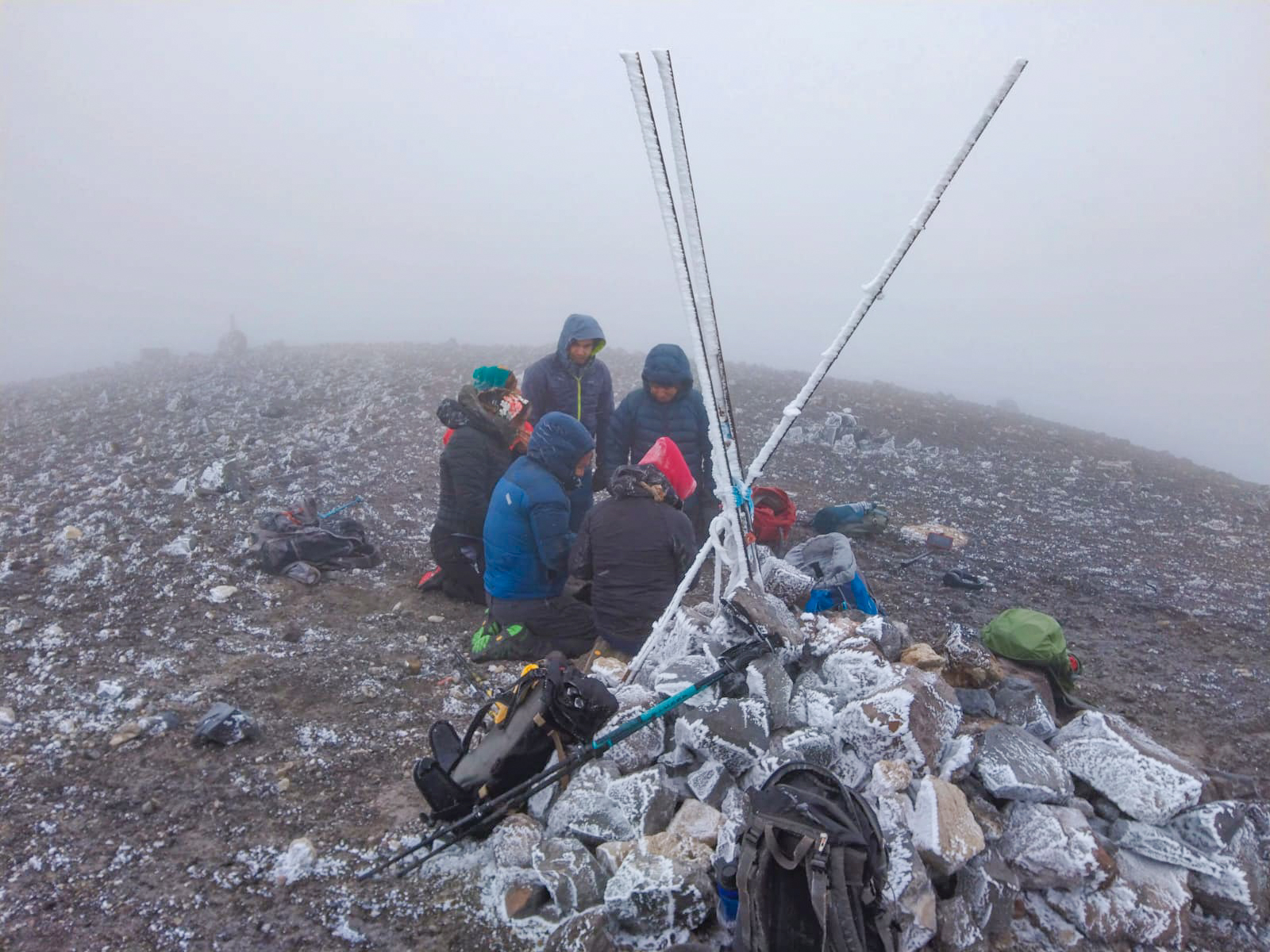
Although situated in the driest desert on earth outside polar regions, mountain weather at high elevation can be unpredictable. On the morning of my climb, a sudden unseasonal snowstorm hit the mountain. Fortunately, all other participants canceled their tour, allowing me to climb the volcano alone with my mountain guide. Reaching the summit crater, an extraordinary surprise awaited: because the ascent took place on the summer solstice, local Chilean pilgrims had journeyed to the volcano to conduct a traditional ceremony, in which we were invited to participate. After the thirty minute ceremony in the freezing wind, I was thoroughly chilled and relieved to begin the descent.
| Location | Central Andes, Antofagasta Region, Chile |
| Activity Type | High Altitude Active Volcano Ascent |
| Elevation Gain | 900 m vertical climb |
| Highest Point | 5592 m (Active Crater Rim) |
| Duration | Full Day (7 to 8 hours total, 2 hours ascent) |
| Difficulty | Strenuous High Altitude (thin air, sulfur fumaroles, scree) |
| Starting Point | Laguna Lejía approach road from San Pedro de Atacama |
| Best Season | Year round (watch for Altiplanic summer storms) |
| Date Visited | December 21, 2021 |
TRAILHEAD AND PLANNING LOGISTICS
The expedition begins before dawn from San Pedro de Atacama, driving southeast past the high altitude lake of Laguna Lejía to reach the base camp trailhead at approximately 4700 meters. A robust four wheel drive vehicle is mandatory for the rough volcanic sand track.
Ascending above 5500 meters demands proper acclimatization. Climbers should spend at least three to four days undertaking progressively higher excursions in the Atacama region before attempting Láscar. An experienced local mountain guide is essential for monitoring weather, route finding through volcanic scree, and managing altitude safety.
THE ROUTE AND TRAIL REPORT
The High Plateau Approach: The drive passes the saline shores of Laguna Lejía, where Andean flamingos wade and wild herds of vicuñas roam the high tussock grassland beneath sweeping volcanic peaks.
The Volcanic Scree Ascent: Starting at 4700 meters, the trail climbs relentlessly across steep volcanic ash, pumice, and loose scree switchbacks. On my climb, falling snow blanketed the dark volcanic slopes, creating surreal contrasts of white snow on black rock. Taking steady, measured steps and maintaining a consistent breathing rhythm is key to managing the thin air.
The Active Crater Rim & Solstice Ceremony: Topping out on the crater rim at 5592 meters reveals the gaping volcanic abyss dropping 300 meters into the earth, with sulfur fumes hissing from vents along the crater walls. Participating in the solstice ceremony on the edge of the crater alongside local pilgrims was a profound and memorable experience, though enduring the subzero wind chill at nearly 5600 meters left us completely frozen before the fast scree descent back to the vehicle.
PRACTICAL TIPS AND ESSENTIALS
Mountaineering Layers: Wind and temperature on the crater rim can plunge well below freezing. Wear heavy thermal base layers, a windproof mountaineering parka, warm gloves, a balaclava, and sunglasses.
Hydration & Nutrition: Bring a thermos of hot tea and easily digestible energy snacks. Appetite is typically suppressed at high altitude, so deliberate fueling is essential.
PHOTO GALLERY

On the hike up 


Completely alone on a lake Completely 
A Wild Donkey on the Roadside On the hike down 
Lascar Vulcano still in the clouds On top of the Vulcano on 5952m