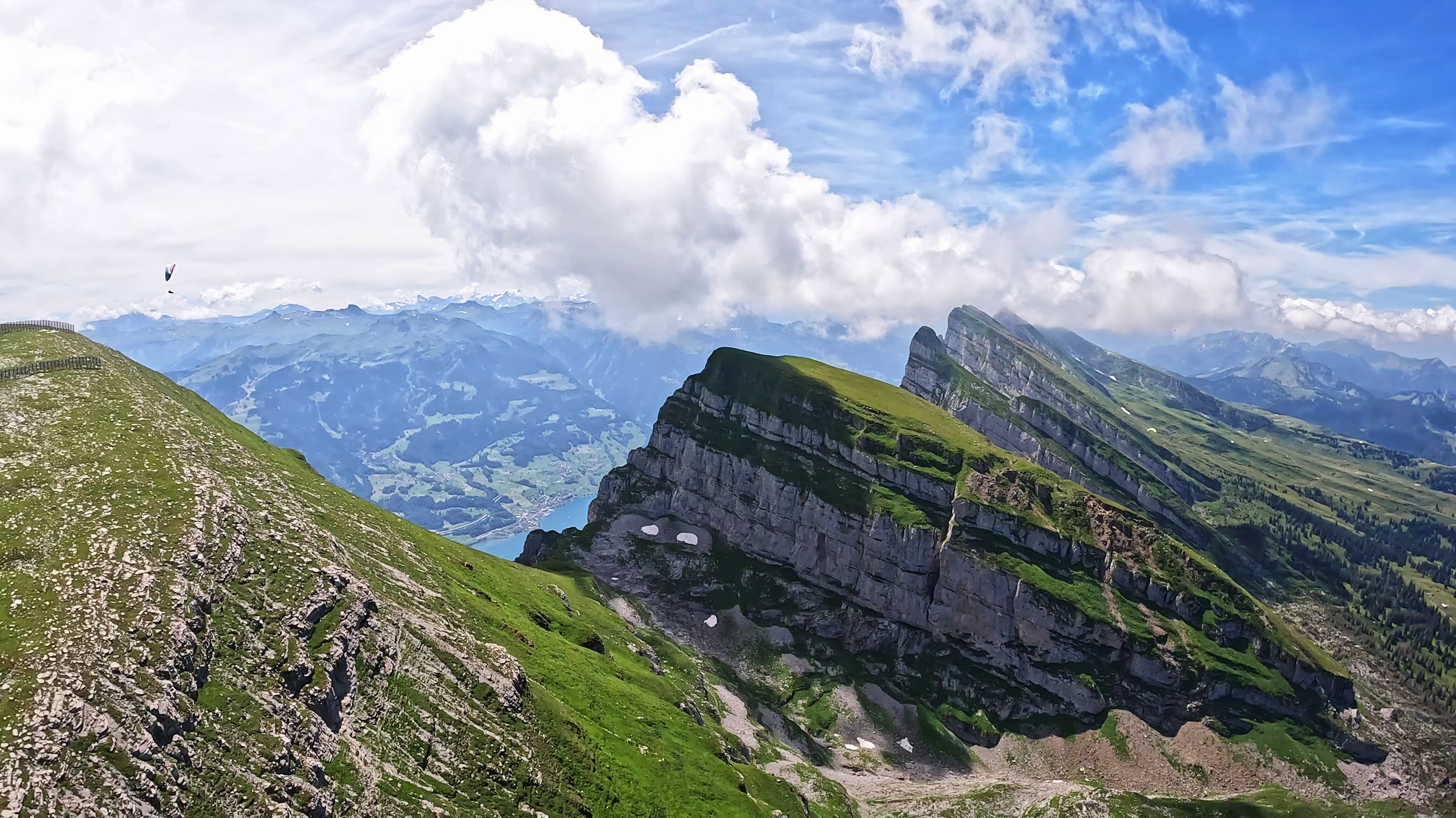
SPOT OVERVIEW
Chäserrugg is the easternmost peak of the world renowned Churfirsten range in the Toggenburg valley of Canton St. Gallen, towering at approximately 2262 to 2300 meters above sea level. Featuring sheer vertical rock walls dropping thousands of meters down to the fjord like waters of Lake Walen on the south, and panoramic vistas over the Säntis massif on the north, Chäserrugg is one of the grandest high alpine flight arenas in Switzerland.
FLIGHT CHARACTERISTICS AND WIND
Thanks to its immense alpine relief and altitude, Chäserrugg delivers powerful thermal climbs and serves as a premier springboard for ambitious cross country routes across eastern Switzerland. Takeoffs can be made in north, northwest, west, and south directions. Vital safety warning: Flying south of the Churfirsten ridge directly over the dramatic drop toward Lake Walen is extremely treacherous. Powerful thermal down drafts and severe leeward rotors make returning back over the ridge nearly impossible, leaving pilots trapped over sheer vertical cliffs without landing options. Flights must never be undertaken during south foehn.
KEY FLIGHT PARAMETERS
- Primary Wind Directions: North, North West, West, and South
- Flight Type: High alpine thermal flying and cross country route departures
- Best Season: Late spring through autumn (snow often persists on the plateau until late May)
- Takeoff Altitude: 2295 meters above sea level
- Landing Altitude: 904 meters above sea level at Unterwasser
- Elevation Difference: Approximately 1390 meters of massive vertical drop
- Pilot Level: Demanding, suited for experienced pilots comfortable in high alpine environments
- Local Club: Gleitschirmclub Toggenburg (GCT)
FLIGHT IMPRESSIONS
LAUNCH SITE
The takeoff areas are situated on the vast summit plateau, about ten minutes walk from the Chäserrugg mountain station designed by Herzog and de Meuron. Multiple launch sectors allow choices between northwest, west, and south orientations. The terrain consists of high alpine meadow interspersed with rocks, requiring orderly line sorting. A further takeoff towards Hinterrugg is reachable via a scenic fifteen minute alpine walk.
LANDING SITE
The official landing field is located at Unterwasser at approximately 904 meters above sea level, on the large flat meadow right next to the valley funicular station. The field has a windsock. Pilots must pay careful attention to the Toggenburg valley wind system, which can become strong during warm afternoons, and remain vigilant of high voltage power lines running on the slope near Iltios.
AIRSPACE AND SAFETY
Always inspect the daily Swiss airspace bulletin (DABS) before flight. In high alpine terrain, wind speeds can intensify rapidly. Thermal rotors are common on the southwest ridge crest. A small landing fee is collected at the mountain railway ticket counter to help fund landing site agreements.
GPS FOR CAR AND GETTING THERE
Drive to Unterwasser in the Toggenburg valley. Take the funicular railway from Unterwasser up to Iltios, then transfer to the aerial tramway up to the summit of Chäserrugg. Large parking areas are available directly at the valley station.
USEFUL LINKS AND CLUB INFO
The site is supported by the Gleitschirmclub Toggenburg. Information boards, live webcams, and weather stations are accessible through the Toggenburg Bergbahnen portal.

